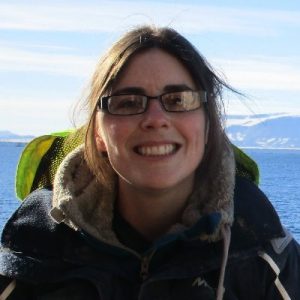
 Dr Louise Callard – Lecturer in Physical Geography and TEL co-lead for the School of Geography, Politics and Sociology
What did you do?
Use ArcGIS Storymaps to produce virtual field trip for second-year physical geographers (Module: Key Methods for Physical Geography GEO2137).
Who is involved?
Dr Louise Callard, Dr Maarten van Hardenbroek, Professor Andrew Russel.
How did you do it?
In a “normal” year, we spend 6-7 hours on the Northumberland coast, teaching students field techniques. We get the students to collect data and material to analyse in the lab. This field trip forms foundation to a portfolio assessment worth 40%. We really wanted to retain that for the virtual element as well, where the students still had to collect data and understand the field techniques.
This year, we produced three asynchronous field trips split over three weeks. We used ArcGIS StoryMaps as the base platform to produce narrative, interactive map, photos (including 360o), videos, activities and questions. It was supported with drop-in sessions, quizzes, discussion boards and synchronous practicals. All these were to make sure the students remained engaged, and all the activities had a purpose.
See below the presentation of Dr Louise Callard about the virtual fieldwork, given during the Art of the Possible week.
Why did you do it?
To provide the students with skills and confidence to use a range of geographical methods and analytical techniques: fieldwork, laboratory, computer practicals (GIS and statistical analysis). We wanted to create an active environment, where the students had to collect data that was going to be used for the assessment.
Did it work?
We found that we got really good engagement, with a high uptake when the virtual field trip went live, and persistent activity, particularly towards the assessment deadline when students were revisiting the material. Fieldtrips are not normally recorded, with students depending on their notes taken when in the field, so being able to revisit the material was a great advantage of using online field activities.
The quality and understanding of submitted work appeared to be the same as in previous years. Also, with the opportunity to revisit the virtual field trip, we got significantly less e-mail traffic and fewer questions related to the field elements.
Student Voice
Students were obviously a bit disappointed – they wanted to go in the field. However, they still found this was a good way of learning some field techniques and data analysis.
The link to the virtual field trip works well and has a nice layout.
It was presented clearly with good sections to work through.
I found this good – well set out and easy to follow. I perhaps did not take as much as I was not there but it was a great alternative.
I liked the fact that it was a different method of learning to lectures and you had to be more involved and engaged with the content.
Positives of ArcGIS StoryMaps and virtual field teaching
- Newcastle University has a license
- It is quick and easy to use (it does take time to collect and prepare resources, e.g. videos).
- It can be used on various devices: computers, mobile phones, tablets. This also makes it mobile – students can access the ArcGIS StoryMaps during the field trip on their mobiles.
- It looks really good
- Students can revisit the information and refresh the memory.
- It is also a good alternative for students who cannot join the field trip
Graduate Framework
This approach develops the following attributes:
- Engaged
- Confident
- Curious
- Digitally capable
Find out more about the Graduate Framework.
Interested in finding out more?
Take a look at these resources:
To find out more get in touch with Dr Louise Callard.
